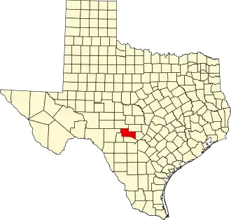
Kerr County
| County in de Verenigde Staten | |||
|---|---|---|---|
| |||
| Situering | |||
| Staat | Texas | ||
| Coördinaten | 30°3'36"NB, 99°21'0"WL | ||
| Algemeen | |||
| Oppervlakte | 2.869 km² | ||
| - land | 2.865 km² | ||
| - water | 4 km² | ||
| Inwoners (2000) |
43.653 (15 inw./km²) | ||
| Overig | |||
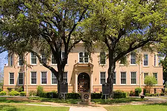
| Zetel | Kerrville | ||
| FIPS-code | 48265 | ||
| Opgericht | 1856 | ||
| Website | www | ||
| Foto's | |||
| |||
| Kerr County Courthouse | |||
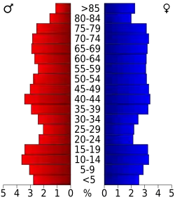 Bevolkingspiramide Kerr County | |||
| Statistieken volkstelling Kerr County | |||
| |||
Kerr County is een van de 254 county's in de Amerikaanse staat Texas.
De county heeft een landoppervlakte van 2.865 km² en telt 43.653 inwoners (volkstelling 2000). De hoofdplaats is Kerrville.
Bevolkingsontwikkeling
| Jaar | Inwoners | % ± | |
|---|---|---|---|
| 1900 | 4.980 | — | |
| 1910 | 5.505 | 10,5% | |
| 1920 | 5.842 | 6,1% | |
| 1930 | 10.151 | 73,8% | |
| 1940 | 11.650 | 14,8% | |
| 1950 | 14.022 | 20,4% | |
| 1960 | 16.800 | 19,8% | |
| 1970 | 19.454 | 15,8% | |
| 1980 | 28.780 | 47,9% | |
| 1990 | 36.304 | 26,1% | |
| 2000 | 43.653 | 20,2% | |
| Bron: (en) Historical Decennial Census Population | |||