Terry County
| County in de Verenigde Staten | |||
|---|---|---|---|
| |||
| Situering | |||
| Staat | Texas | ||
| Coördinaten | 33°10'12"NB, 102°20'24"WL | ||
| Algemeen | |||
| Oppervlakte | 2.308 km² | ||
| - land | 2.305 km² | ||
| - water | 3 km² | ||
| Inwoners (2000) |
12.761 (6 inw./km²) | ||
| Overig | |||
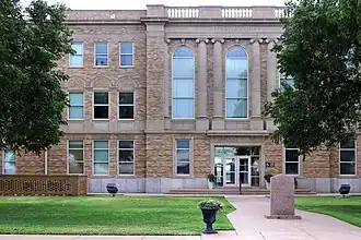
| Zetel | Brownfield | ||
| FIPS-code | 48445 | ||
| Opgericht | 1876 | ||
| Website | www | ||
| Foto's | |||
| |||
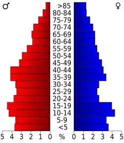 Bevolkingspiramide Terry County | |||
| Statistieken volkstelling Terry County | |||
| |||
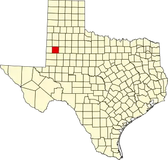
Terry County is een van de 254 county's in de Amerikaanse staat Texas.
De county heeft een landoppervlakte van 2.305 km² en telt 12.761 inwoners (volkstelling 2000). De hoofdplaats is Brownfield.
Bevolkingsontwikkeling
| Jaar | Inwoners | % ± | |
|---|---|---|---|
| 1900 | 48 | — | |
| 1910 | 1.474 | 2.970,8% | |
| 1920 | 2.236 | 51,7% | |
| 1930 | 8.883 | 297,3% | |
| 1940 | 11.160 | 25,6% | |
| 1950 | 13.107 | 17,4% | |
| 1960 | 16.286 | 24,3% | |
| 1970 | 14.118 | −13,3% | |
| 1980 | 14.581 | 3,3% | |
| 1990 | 13.218 | −9,3% | |
| 2000 | 12.761 | −3,5% | |
| Bron: (en) Historical Decennial Census Population | |||