Wharton County
| County in de Verenigde Staten | |||
|---|---|---|---|
| |||
| Situering | |||
| Staat | Texas | ||
| Coördinaten | 29°16'48"NB, 96°13'12"WL | ||
| Algemeen | |||
| Oppervlakte | 2.834 km² | ||
| - land | 2.823 km² | ||
| - water | 11 km² | ||
| Inwoners (2000) |
41.188 (15 inw./km²) | ||
| Overig | |||
| Zetel | Wharton | ||
| FIPS-code | 48481 | ||
| Opgericht | 1846 | ||
| Website | www | ||
| Foto's | |||

| |||
 Bevolkingspiramide Wharton County | |||
| Statistieken volkstelling Wharton County | |||
| |||
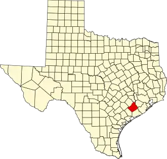
Wharton County is een van de 254 county's in de Amerikaanse staat Texas.
De county heeft een landoppervlakte van 2.823 km² en telt 41.188 inwoners (volkstelling 2000). De hoofdplaats is Wharton.
Bevolkingsontwikkeling
| Jaar | Inwoners | % ± | |
|---|---|---|---|
| 1900 | 16.942 | — | |
| 1910 | 21.123 | 24,7% | |
| 1920 | 24.288 | 15,0% | |
| 1930 | 29.681 | 22,2% | |
| 1940 | 36.158 | 21,8% | |
| 1950 | 36.077 | −0,2% | |
| 1960 | 38.152 | 5,8% | |
| 1970 | 36.729 | −3,7% | |
| 1980 | 40.242 | 9,6% | |
| 1990 | 39.955 | −0,7% | |
| 2000 | 41.188 | 3,1% | |
| Bron: (en) Historical Decennial Census Population | |||