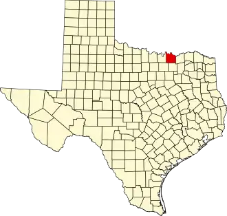
Grayson County (Texas)
| County in de Verenigde Staten | |||
|---|---|---|---|
| |||
| Situering | |||
| Staat | Texas | ||
| Coördinaten | 33°37'12"NB, 96°40'48"WL | ||
| Algemeen | |||
| Oppervlakte | 2.536 km² | ||
| - land | 2.418 km² | ||
| - water | 118 km² | ||
| Inwoners (2000) |
110.595 (46 inw./km²) | ||
| Overig | |||
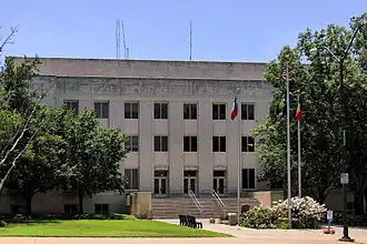
| Zetel | Sherman | ||
| FIPS-code | 48181 | ||
| Opgericht | 1846 | ||
| Website | www | ||
| Foto's | |||
| |||
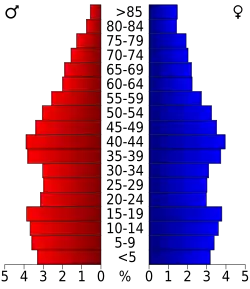 Bevolkingspiramide Grayson County | |||
| Statistieken volkstelling Grayson County | |||
| |||
Grayson County is een van de 254 county's in de Amerikaanse staat Texas.
De county heeft een landoppervlakte van 2.418 km² en telt 110.595 inwoners (volkstelling 2000). De hoofdplaats is Sherman.
Bevolkingsontwikkeling
| Jaar | Inwoners | % ± | |
|---|---|---|---|
| 1900 | 63.661 | — | |
| 1910 | 65.996 | 3,7% | |
| 1920 | 74.165 | 12,4% | |
| 1930 | 65.843 | −11,2% | |
| 1940 | 69.499 | 5,6% | |
| 1950 | 70.467 | 1,4% | |
| 1960 | 73.043 | 3,7% | |
| 1970 | 83.225 | 13,9% | |
| 1980 | 89.796 | 7,9% | |
| 1990 | 95.021 | 5,8% | |
| 2000 | 110.595 | 16,4% | |
| Bron: (en) Historical Decennial Census Population | |||