La Salle County (Texas)
| County in de Verenigde Staten | |||
|---|---|---|---|
| |||
| Situering | |||
| Staat | Texas | ||
| Coördinaten | 28°20'24"NB, 99°6'0"WL | ||
| Algemeen | |||
| Oppervlakte | 3.870 km² | ||
| - land | 3.856 km² | ||
| - water | 14 km² | ||
| Inwoners (2000) |
5.866 (2 inw./km²) | ||
| Overig | |||
| Zetel | Cotulla | ||
| FIPS-code | 48283 | ||
| Opgericht | 1858 | ||
| Website | www | ||
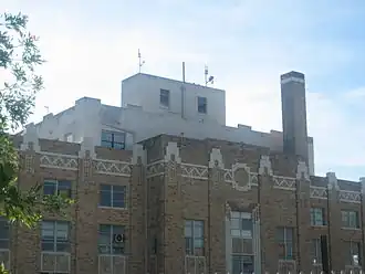
| Foto's | |||

| |||
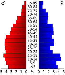 Bevolkingspiramide La Salle County | |||
| Statistieken volkstelling La Salle County | |||
| |||
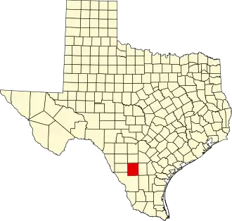
La Salle County is een van de 254 county's in de Amerikaanse staat Texas.
De county heeft een landoppervlakte van 3.856 km² en telt 5.866 inwoners (volkstelling 2000). De hoofdplaats is Cotulla.
Bevolkingsontwikkeling
| Jaar | Inwoners | % ± | |
|---|---|---|---|
| 1900 | 2.303 | — | |
| 1910 | 4.747 | 106,1% | |
| 1920 | 4.821 | 1,6% | |
| 1930 | 8.228 | 70,7% | |
| 1940 | 8.003 | −2,7% | |
| 1950 | 7.485 | −6,5% | |
| 1960 | 5.972 | −20,2% | |
| 1970 | 5.014 | −16,0% | |
| 1980 | 5.514 | 10,0% | |
| 1990 | 5.254 | −4,7% | |
| 2000 | 5.866 | 11,6% | |
| Bron: (en) Historical Decennial Census Population | |||