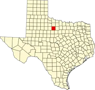
Throckmorton County
| County in de Verenigde Staten | |||
|---|---|---|---|
| |||
| Situering | |||
| Staat | Texas | ||
| Coördinaten | 33°10'48"NB, 99°12'36"WL | ||
| Algemeen | |||
| Oppervlakte | 2.371 km² | ||
| - land | 2.363 km² | ||
| - water | 8 km² | ||
| Inwoners (2000) |
1.850 (1 inw./km²) | ||
| Overig | |||
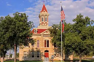
| Zetel | Throckmorton | ||
| FIPS-code | 48447 | ||
| Opgericht | 1858 | ||
| Website | www | ||
| Foto's | |||
| |||
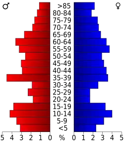 Bevolkingspiramide Throckmorton County | |||
| Statistieken volkstelling Throckmorton County | |||
| |||
Throckmorton County is een van de 254 county's in de Amerikaanse staat Texas.
De county heeft een landoppervlakte van 2.363 km² en telt 1.850 inwoners (volkstelling 2000). De hoofdplaats is Throckmorton.
Bevolkingsontwikkeling
| Jaar | Inwoners | % ± | |
|---|---|---|---|
| 1900 | 1.750 | — | |
| 1910 | 4.563 | 160,7% | |
| 1920 | 3.589 | −21,3% | |
| 1930 | 5.253 | 46,4% | |
| 1940 | 4.275 | −18,6% | |
| 1950 | 3.618 | −15,4% | |
| 1960 | 2.767 | −23,5% | |
| 1970 | 2.205 | −20,3% | |
| 1980 | 2.053 | −6,9% | |
| 1990 | 1.880 | −8,4% | |
| 2000 | 1.850 | −1,6% | |
| Bron: (en) Historical Decennial Census Population | |||