Erath County
| County in de Verenigde Staten | |||
|---|---|---|---|
| |||
| Situering | |||
| Staat | Texas | ||
| Coördinaten | 32°13'48"NB, 98°13'12"WL | ||
| Algemeen | |||
| Oppervlakte | 2.823 km² | ||
| - land | 2.814 km² | ||
| - water | 9 km² | ||
| Inwoners (2000) |
33.001 (12 inw./km²) | ||
| Overig | |||
| Zetel | Stephenville | ||
| FIPS-code | 48143 | ||
| Opgericht | 1856 | ||
| Website | www | ||
| Foto's | |||

| |||
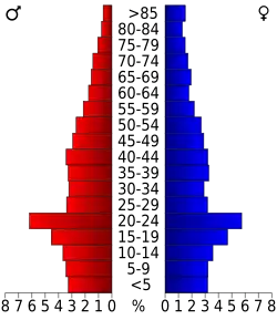 Bevolkingspiramide Erath County | |||
| Statistieken volkstelling Erath County | |||
| |||
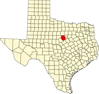
Erath County is een van de 254 county's in de Amerikaanse staat Texas.
De county heeft een landoppervlakte van 2.814 km² en telt 33.001 inwoners (volkstelling 2000). De hoofdplaats is Stephenville.
Bevolkingsontwikkeling
| Jaar | Inwoners | % ± | |
|---|---|---|---|
| 1900 | 29.966 | — | |
| 1910 | 32.095 | 7,1% | |
| 1920 | 28.385 | −11,6% | |
| 1930 | 20.804 | −26,7% | |
| 1940 | 20.760 | −0,2% | |
| 1950 | 18.434 | −11,2% | |
| 1960 | 16.236 | −11,9% | |
| 1970 | 18.141 | 11,7% | |
| 1980 | 22.560 | 24,4% | |
| 1990 | 27.991 | 24,1% | |
| 2000 | 33.001 | 17,9% | |
| Bron: (en) Historical Decennial Census Population | |||