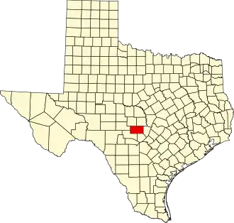
Gillespie County
| County in de Verenigde Staten | |||
|---|---|---|---|
| |||
| Situering | |||
| Staat | Texas | ||
| Coördinaten | 30°18'36"NB, 98°57'0"WL | ||
| Algemeen | |||
| Oppervlakte | 2.749 km² | ||
| - land | 2.748 km² | ||
| - water | 1 km² | ||
| Inwoners (2000) |
20.814 (8 inw./km²) | ||
| Overig | |||
| Zetel | Fredericksburg | ||
| FIPS-code | 48171 | ||
| Opgericht | 1848 | ||
| Website | www | ||
| Foto's | |||

| |||
 Bevolkingspiramide Gillespie County | |||
| Statistieken volkstelling Gillespie County | |||
| |||
Gillespie County is een van de 254 county's in de Amerikaanse staat Texas.
De county heeft een landoppervlakte van 2.748 km² en telt 20.814 inwoners (volkstelling 2000). De hoofdplaats is Fredericksburg.
In de county ligt een deel van het Enchanted Rock State Natural Area.
Bevolkingsontwikkeling
| Jaar | Inwoners | % ± | |
|---|---|---|---|
| 1900 | 8.229 | — | |
| 1910 | 9.447 | 14,8% | |
| 1920 | 10.015 | 6,0% | |
| 1930 | 11.020 | 10,0% | |
| 1940 | 10.670 | −3,2% | |
| 1950 | 10.520 | −1,4% | |
| 1960 | 10.048 | −4,5% | |
| 1970 | 10.553 | 5,0% | |
| 1980 | 13.532 | 28,2% | |
| 1990 | 17.204 | 27,1% | |
| 2000 | 20.814 | 21,0% | |
| Bron: (en) Historical Decennial Census Population | |||