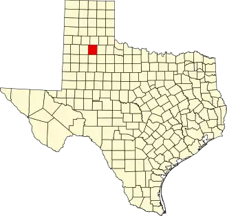
Floyd County (Texas)
| County in de Verenigde Staten | |||
|---|---|---|---|
| |||
| Situering | |||
| Staat | Texas | ||
| Coördinaten | 34°4'12"NB, 101°18'0"WL | ||
| Algemeen | |||
| Oppervlakte | 2.571 km² | ||
| - land | 2.570 km² | ||
| - water | 1 km² | ||
| Inwoners (2000) |
7.771 (3 inw./km²) | ||
| Overig | |||
| Zetel | Floydada | ||
| FIPS-code | 48153 | ||
| Opgericht | 1876 | ||
| Website | www | ||
| Foto's | |||

| |||
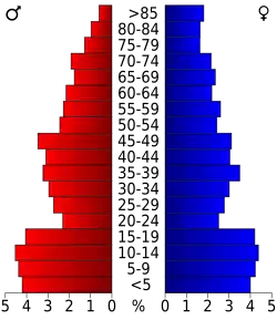 Bevolkingspiramide Floyd County | |||
| Statistieken volkstelling Floyd County | |||
| |||
Floyd County is een van de 254 county's in de Amerikaanse staat Texas.
De county heeft een landoppervlakte van 2.570 km² en telt 7.771 inwoners (volkstelling 2000). De hoofdplaats is Floydada.
Bevolkingsontwikkeling
| Jaar | Inwoners | % ± | |
|---|---|---|---|
| 1900 | 2.020 | — | |
| 1910 | 4.638 | 129,6% | |
| 1920 | 9.758 | 110,4% | |
| 1930 | 12.409 | 27,2% | |
| 1940 | 10.659 | −14,1% | |
| 1950 | 10.535 | −1,2% | |
| 1960 | 12.369 | 17,4% | |
| 1970 | 11.044 | −10,7% | |
| 1980 | 9.834 | −11,0% | |
| 1990 | 8.497 | −13,6% | |
| 2000 | 7.771 | −8,5% | |
| Bron: (en) Historical Decennial Census Population | |||