Baylor County
| County in de Verenigde Staten | |||
|---|---|---|---|
| |||
| Situering | |||
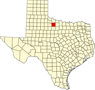
| Staat | Texas | ||
| Coördinaten | 33°37'48"NB, 99°13'12"WL | ||
| Algemeen | |||
| Oppervlakte | 2.333 km² | ||
| - land | 2.255 km² | ||
| - water | 78 km² | ||
| Inwoners (2000) |
4.093 (2 inw./km²) | ||
| Overig | |||
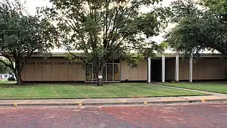
| Zetel | Seymour | ||
| FIPS-code | 48023 | ||
| Opgericht | 1858 | ||
| Website | www | ||
| Foto's | |||
| |||
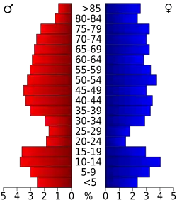 Bevolkingspiramide Baylor County | |||
| Statistieken volkstelling Baylor County | |||
| |||
Baylor County is een van de 254 county's in de Amerikaanse staat Texas.
De county heeft een landoppervlakte van 2.255 km² en telt 4.093 inwoners (volkstelling 2000). De hoofdplaats is Seymour.
Bevolkingsontwikkeling
| Jaar | Inwoners | % ± | |
|---|---|---|---|
| 1900 | 3.052 | — | |
| 1910 | 8.411 | 175,6% | |
| 1920 | 7.027 | −16,5% | |
| 1930 | 7.418 | 5,6% | |
| 1940 | 7.755 | 4,5% | |
| 1950 | 6.875 | −11,3% | |
| 1960 | 5.893 | −14,3% | |
| 1970 | 5.221 | −11,4% | |
| 1980 | 4.919 | −5,8% | |
| 1990 | 4.385 | −10,9% | |
| 2000 | 4.093 | −6,7% | |
| Bron: (en) Historical Decennial Census Population | |||