Tucker County
| County in de Verenigde Staten | |||
|---|---|---|---|
| |||
| Situering | |||
| Staat | West Virginia | ||
| Tijdzone | Eastern Standard Time (UTC−5) | ||
| Coördinaten | 39°6'0"NB, 79°34'12"WL | ||
| Algemeen | |||
| Oppervlakte | 1.091 km² | ||
| - land | 1.085 km² | ||
| - water | 6 km² | ||
| Inwoners (2000) |
7.321 (7 inw./km²) | ||
| Overig | |||
| Zetel | Parsons | ||
| FIPS-code | 54093 | ||
| Opgericht | 1856 | ||
| Website | www | ||
| Foto's | |||

| |||
 Bevolkingspiramide Tucker County | |||
| Statistieken volkstelling Tucker County | |||
| |||
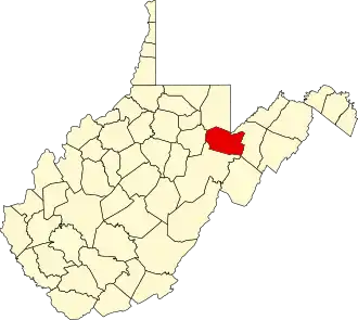
Tucker County is een van de 55 county's in de Amerikaanse staat West Virginia.
De county heeft een landoppervlakte van 1.085 km² en telt 7.321 inwoners (volkstelling 2000). De hoofdplaats is Parsons.
Bevolkingsontwikkeling
| Jaar | Inwoners | % ± | |
|---|---|---|---|
| 1900 | 13.433 | — | |
| 1910 | 18.675 | 39,0% | |
| 1920 | 16.791 | −10,1% | |
| 1930 | 13.374 | −20,4% | |
| 1940 | 13.173 | −1,5% | |
| 1950 | 10.600 | −19,5% | |
| 1960 | 7.750 | −26,9% | |
| 1970 | 7.447 | −3,9% | |
| 1980 | 8.675 | 16,5% | |
| 1990 | 7.728 | −10,9% | |
| 2000 | 7.321 | −5,3% | |
| Bron: (en) Historical Decennial Census Population | |||