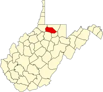
Marion County (West Virginia)
| County in de Verenigde Staten | |||
|---|---|---|---|
| |||
| Situering | |||
| Staat | West Virginia | ||
| Tijdzone | Eastern Standard Time (UTC−5) | ||
| Coördinaten | 39°30'36"NB, 80°14'24"WL | ||
| Algemeen | |||
| Oppervlakte | 807 km² | ||
| - land | 802 km² | ||
| - water | 5 km² | ||
| Inwoners (2000) |
56.598 (71 inw./km²) | ||
| Overig | |||
| Zetel | Fairmont | ||
| FIPS-code | 54049 | ||
| Opgericht | 1842 | ||
| Website | www | ||
| Foto's | |||

| |||
 Bevolkingspiramide Marion County | |||
| Statistieken volkstelling Marion County | |||
| |||
Marion County is een van de 55 county's in de Amerikaanse staat West Virginia.
De county heeft een landoppervlakte van 802 km² en telt 56.598 inwoners (volkstelling 2000). De hoofdplaats is Fairmont.
Bevolkingsontwikkeling
| Jaar | Inwoners | % ± | |
|---|---|---|---|
| 1900 | 32.430 | — | |
| 1910 | 42.794 | 32,0% | |
| 1920 | 54.571 | 27,5% | |
| 1930 | 66.655 | 22,1% | |
| 1940 | 68.683 | 3,0% | |
| 1950 | 71.521 | 4,1% | |
| 1960 | 63.717 | −10,9% | |
| 1970 | 61.356 | −3,7% | |
| 1980 | 65.789 | 7,2% | |
| 1990 | 57.249 | −13,0% | |
| 2000 | 56.598 | −1,1% | |
| Bron: (en) Historical Decennial Census Population | |||