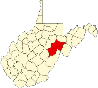
Randolph County (West Virginia)
| County in de Verenigde Staten | |||
|---|---|---|---|
| |||
| Situering | |||
| Staat | West Virginia | ||
| Tijdzone | Eastern Standard Time (UTC−5) | ||
| Coördinaten | 38°46'48"NB, 79°52'12"WL | ||
| Algemeen | |||
| Oppervlakte | 2.694 km² | ||
| - land | 2.693 km² | ||
| - water | 1 km² | ||
| Inwoners (2000) |
28.262 (10 inw./km²) | ||
| Overig | |||
| Zetel | Elkins | ||
| FIPS-code | 54083 | ||
| Opgericht | 1786 | ||
| Website | randolphcountycommissionwv | ||
| Foto's | |||

| |||
 Bevolkingspiramide Randolph County | |||
| Statistieken volkstelling Randolph County | |||
| |||
Randolph County is een van de 55 county's in de Amerikaanse staat West Virginia.
De county heeft een landoppervlakte van 2.693 km² en telt 28.262 inwoners (volkstelling 2000). De hoofdplaats is Elkins.
Bevolkingsontwikkeling
| Jaar | Inwoners | % ± | |
|---|---|---|---|
| 1900 | 17.670 | — | |
| 1910 | 26.028 | 47,3% | |
| 1920 | 26.804 | 3,0% | |
| 1930 | 25.049 | −6,5% | |
| 1940 | 30.259 | 20,8% | |
| 1950 | 30.558 | 1,0% | |
| 1960 | 26.349 | −13,8% | |
| 1970 | 24.596 | −6,7% | |
| 1980 | 28.734 | 16,8% | |
| 1990 | 27.803 | −3,2% | |
| 2000 | 28.262 | 1,7% | |
| Bron: (en) Historical Decennial Census Population | |||