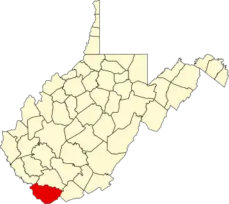
McDowell County (West Virginia)
| County in de Verenigde Staten | |||
|---|---|---|---|
| |||
| Situering | |||
| Staat | West Virginia | ||
| Tijdzone | Eastern Standard Time (UTC−5) | ||
| Coördinaten | 37°22'12"NB, 81°39'0"WL | ||
| Algemeen | |||
| Oppervlakte | 1.385 km² | ||
| - land | 1.385 km² | ||
| - water | 0 km² | ||
| Inwoners (2000) |
27.329 (20 inw./km²) | ||
| Overig | |||
| Zetel | Welch | ||
| FIPS-code | 54047 | ||
| Opgericht | 1858 | ||
| Website | www | ||
| Foto's | |||

| |||
 Bevolkingspiramide McDowell County | |||
| Statistieken volkstelling McDowell County | |||
| |||
McDowell County is een van de 55 county's in de Amerikaanse staat West Virginia.
De county heeft een landoppervlakte van 1.385 km² en telt 27.329 inwoners (volkstelling 2000). De hoofdplaats is Welch.
Bevolkingsontwikkeling
| Jaar | Inwoners | % ± | |
|---|---|---|---|
| 1900 | 18.747 | — | |
| 1910 | 47.856 | 155,3% | |
| 1920 | 68.571 | 43,3% | |
| 1930 | 90.479 | 31,9% | |
| 1940 | 94.354 | 4,3% | |
| 1950 | 98.887 | 4,8% | |
| 1960 | 71.359 | −27,8% | |
| 1970 | 50.666 | −29,0% | |
| 1980 | 49.899 | −1,5% | |
| 1990 | 35.233 | −29,4% | |
| 2000 | 27.329 | −22,4% | |
| Bron: (en) Historical Decennial Census Population | |||