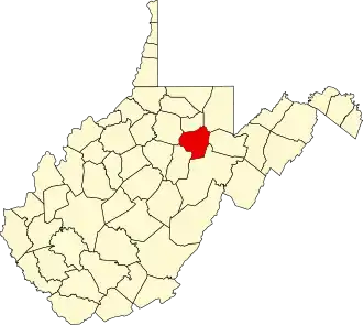
Barbour County (West Virginia)
| County in de Verenigde Staten | |||
|---|---|---|---|
| |||
| Situering | |||
| Staat | West Virginia | ||
| Tijdzone | Eastern Standard Time (UTC−5) | ||
| Coördinaten | 39°7'48"NB, 80°0'0"WL | ||
| Algemeen | |||
| Oppervlakte | 888 km² | ||
| - land | 883 km² | ||
| - water | 5 km² | ||
| Inwoners (2000) |
15.557 (18 inw./km²) | ||
| Overig | |||
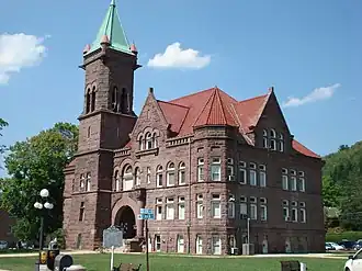
| Zetel | Philippi | ||
| FIPS-code | 54001 | ||
| Opgericht | 1843 | ||
| Website | barbourcountywv | ||
| Foto's | |||
| |||
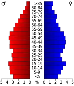 Bevolkingspiramide Barbour County | |||
| Statistieken volkstelling Barbour County | |||
| |||
Barbour County is een van de 55 county's in de Amerikaanse staat West Virginia.
De county heeft een landoppervlakte van 883 km² en telt 15.557 inwoners (volkstelling 2000). De hoofdplaats is Philippi.
Bevolkingsontwikkeling
| Jaar | Inwoners | % ± | |
|---|---|---|---|
| 1900 | 14.198 | — | |
| 1910 | 15.858 | 11,7% | |
| 1920 | 18.028 | 13,7% | |
| 1930 | 18.628 | 3,3% | |
| 1940 | 19.869 | 6,7% | |
| 1950 | 19.745 | −0,6% | |
| 1960 | 15.474 | −21,6% | |
| 1970 | 14.030 | −9,3% | |
| 1980 | 16.639 | 18,6% | |
| 1990 | 15.699 | −5,6% | |
| 2000 | 15.557 | −0,9% | |
| Bron: (en) Historical Decennial Census Population | |||