Mason County (West Virginia)
| County in de Verenigde Staten | |||
|---|---|---|---|
| |||
| Situering | |||
| Staat | West Virginia | ||
| Tijdzone | Eastern Standard Time (UTC−5) | ||
| Coördinaten | 38°46'12"NB, 82°1'12"WL | ||
| Algemeen | |||
| Oppervlakte | 1.152 km² | ||
| - land | 1.118 km² | ||
| - water | 34 km² | ||
| Inwoners (2000) |
25.957 (23 inw./km²) | ||
| Overig | |||
| Zetel | Point Pleasant | ||
| FIPS-code | 54053 | ||
| Opgericht | 1804 | ||
| Website | www | ||
| Foto's | |||

| |||
 Bevolkingspiramide Mason County | |||
| Statistieken volkstelling Mason County | |||
| |||
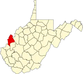
Mason County is een van de 55 county's in de Amerikaanse staat West Virginia.
De county heeft een landoppervlakte van 1.118 km² en telt 25.957 inwoners (volkstelling 2000). De hoofdplaats is Point Pleasant.
Bevolkingsontwikkeling
| Jaar | Inwoners | % ± | |
|---|---|---|---|
| 1900 | 24.142 | — | |
| 1910 | 23.019 | −4,7% | |
| 1920 | 21.459 | −6,8% | |
| 1930 | 20.788 | −3,1% | |
| 1940 | 22.270 | 7,1% | |
| 1950 | 23.537 | 5,7% | |
| 1960 | 24.459 | 3,9% | |
| 1970 | 24.306 | −0,6% | |
| 1980 | 27.045 | 11,3% | |
| 1990 | 25.178 | −6,9% | |
| 2000 | 25.957 | 3,1% | |
| Bron: (en) Historical Decennial Census Population | |||