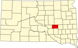
Jerauld County
| County in de Verenigde Staten | |||
|---|---|---|---|
| |||
| Situering | |||
| Staat | South Dakota | ||
| Coördinaten | 44°3'36"NB, 98°37'12"WL | ||
| Algemeen | |||
| Oppervlakte | 1.379 km² | ||
| - land | 1.372 km² | ||
| - water | 7 km² | ||
| Inwoners (2000) |
2.295 (2 inw./km²) | ||
| Overig | |||
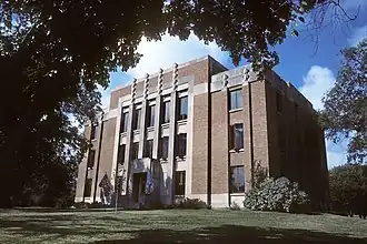
| Zetel | Wessington Springs | ||
| FIPS-code | 46073 | ||
| Opgericht | 1883 | ||
| Website | jerauldcountysd | ||
| Foto's | |||
| |||
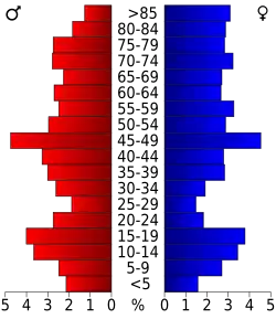 Bevolkingspiramide Jerauld County | |||
| Statistieken volkstelling Jerauld County | |||
| |||
Jerauld County is een van de 66 county's in de Amerikaanse staat South Dakota.
De county heeft een landoppervlakte van 1.372 km² en telt 2.295 inwoners (volkstelling 2000). De hoofdplaats is Wessington Springs.
Bevolkingsontwikkeling
| Jaar | Inwoners | % ± | |
|---|---|---|---|
| 1900 | 2.798 | — | |
| 1910 | 5.120 | 83,0% | |
| 1920 | 6.338 | 23,8% | |
| 1930 | 5.816 | −8,2% | |
| 1940 | 4.752 | −18,3% | |
| 1950 | 4.476 | −5,8% | |
| 1960 | 4.048 | −9,6% | |
| 1970 | 3.310 | −18,2% | |
| 1980 | 2.929 | −11,5% | |
| 1990 | 2.425 | −17,2% | |
| 2000 | 2.295 | −5,4% | |
| Bron: (en) Historical Decennial Census Population | |||