Clay County (South Dakota)
| County in de Verenigde Staten | |||
|---|---|---|---|
| |||
| Situering | |||
| Staat | South Dakota | ||
| Coördinaten | 42°55'12"NB, 96°58'12"WL | ||
| Algemeen | |||
| Oppervlakte | 1.079 km² | ||
| - land | 1.066 km² | ||
| - water | 13 km² | ||
| Inwoners (2000) |
13.537 (13 inw./km²) | ||
| Overig | |||
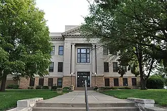
| Zetel | Vermillion (South Dakota) | ||
| FIPS-code | 46027 | ||
| Website | www | ||
| Foto's | |||
| |||
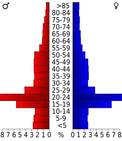 Bevolkingspiramide Clay County | |||
| Statistieken volkstelling Clay County | |||
| |||
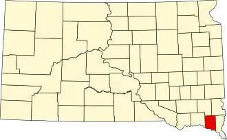
Clay County is een van de 66 county's in de Amerikaanse staat South Dakota.
De county heeft een landoppervlakte van 1.066 km² en telt 13.537 inwoners (volkstelling 2000). De hoofdplaats is Vermillion (South Dakota).
Bevolkingsontwikkeling
| Jaar | Inwoners | % ± | |
|---|---|---|---|
| 1900 | 9.316 | — | |
| 1910 | 8.711 | −6,5% | |
| 1920 | 9.654 | 10,8% | |
| 1930 | 10.088 | 4,5% | |
| 1940 | 9.592 | −4,9% | |
| 1950 | 10.993 | 14,6% | |
| 1960 | 10.810 | −1,7% | |
| 1970 | 12.923 | 19,5% | |
| 1980 | 13.689 | 5,9% | |
| 1990 | 13.186 | −3,7% | |
| 2000 | 13.537 | 2,7% | |
| Bron: (en) Historical Decennial Census Population | |||
Geboren
- Peter Norbeck (1879-1936), gouverneur van South Dakota (1917-1921)