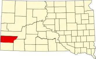
Custer County (South Dakota)
| County in de Verenigde Staten | |||
|---|---|---|---|
| |||
| Situering | |||
| Staat | South Dakota | ||
| Coördinaten | 43°40'48"NB, 103°27'36"WL | ||
| Algemeen | |||
| Oppervlakte | 4.038 km² | ||
| - land | 4.034 km² | ||
| - water | 4 km² | ||
| Inwoners (2000) |
7.275 (2 inw./km²) | ||
| Overig | |||
| Zetel | Custer | ||
| FIPS-code | 46033 | ||
| Website | www | ||
| Foto's | |||

| |||
 Bevolkingspiramide Custer County | |||
| Statistieken volkstelling Custer County | |||
| |||
Custer County is een van de 66 county's in de Amerikaanse staat South Dakota.
De county heeft een landoppervlakte van 4.034 km² en telt 7.275 inwoners (volkstelling 2000). De hoofdplaats is Custer.
Bevolkingsontwikkeling
| Jaar | Inwoners | % ± | |
|---|---|---|---|
| 1900 | 2.728 | — | |
| 1910 | 4.458 | 63,4% | |
| 1920 | 3.907 | −12,4% | |
| 1930 | 5.353 | 37,0% | |
| 1940 | 6.023 | 12,5% | |
| 1950 | 5.517 | −8,4% | |
| 1960 | 4.906 | −11,1% | |
| 1970 | 4.698 | −4,2% | |
| 1980 | 6.000 | 27,7% | |
| 1990 | 6.179 | 3,0% | |
| 2000 | 7.275 | 17,7% | |
| Bron: (en) Historical Decennial Census Population | |||