Wood County (Wisconsin)
| County in de Verenigde Staten | |||
|---|---|---|---|
| |||
| Situering | |||
| Staat | Wisconsin | ||
| Tijdzone | Central Standard Time (UTC−6) | ||
| Coördinaten | 44°27'0"NB, 90°2'24"WL | ||
| Algemeen | |||
| Oppervlakte | 2.096 km² | ||
| - land | 2.053 km² | ||
| - water | 43 km² | ||
| Inwoners (2000) |
75.555 (37 inw./km²) | ||
| Overig | |||
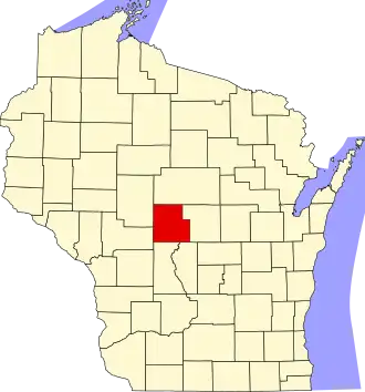
| Zetel | Wisconsin Rapids | ||
| FIPS-code | 55141 | ||
| Opgericht | 1856 | ||
| Website | www | ||
| Foto's | |||

| |||
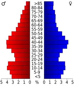 Bevolkingspiramide Wood County | |||
| Statistieken volkstelling Wood County | |||
| |||
Wood County is een van de 72 county's in de Amerikaanse staat Wisconsin.
De county heeft een landoppervlakte van 2.053 km² en telt 75.555 inwoners (volkstelling 2000). De hoofdplaats is Wisconsin Rapids.
Bevolkingsontwikkeling
| Jaar | Inwoners | % ± | |
|---|---|---|---|
| 1900 | 25.865 | — | |
| 1910 | 30.583 | 18,2% | |
| 1920 | 34.643 | 13,3% | |
| 1930 | 37.865 | 9,3% | |
| 1940 | 44.465 | 17,4% | |
| 1950 | 50.500 | 13,6% | |
| 1960 | 59.105 | 17,0% | |
| 1970 | 65.362 | 10,6% | |
| 1980 | 72.799 | 11,4% | |
| 1990 | 73.605 | 1,1% | |
| 2000 | 75.555 | 2,6% | |
| Bron: (en) Historical Decennial Census Population | |||