Richland County (Wisconsin)
| County in de Verenigde Staten | |||
|---|---|---|---|
| |||
| Situering | |||
| Staat | Wisconsin | ||
| Tijdzone | Central Standard Time (UTC−6) | ||
| Coördinaten | 43°22'48"NB, 90°25'48"WL | ||
| Algemeen | |||
| Oppervlakte | 1.526 km² | ||
| - land | 1.518 km² | ||
| - water | 8 km² | ||
| Inwoners (2000) |
17.924 (12 inw./km²) | ||
| Overig | |||
| Zetel | Richland Center | ||
| FIPS-code | 55103 | ||
| Opgericht | 1842 | ||
| Website | www | ||
| Foto's | |||
.jpg)
| |||
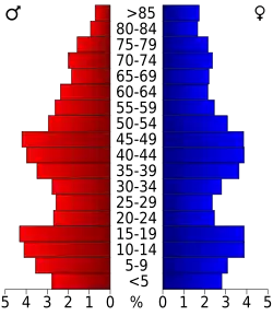 Bevolkingspiramide Richland County | |||
| Statistieken volkstelling Richland County | |||
| |||
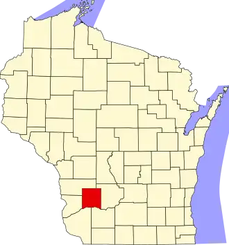
Richland County is een van de 72 county's in de Amerikaanse staat Wisconsin.
De county heeft een landoppervlakte van 1.518 km² en telt 17.924 inwoners (volkstelling 2000). De hoofdplaats is Richland Center.
Bevolkingsontwikkeling
| Jaar | Inwoners | % ± | |
|---|---|---|---|
| 1900 | 19.483 | — | |
| 1910 | 18.809 | −3,5% | |
| 1920 | 19.823 | 5,4% | |
| 1930 | 19.525 | −1,5% | |
| 1940 | 20.381 | 4,4% | |
| 1950 | 19.245 | −5,6% | |
| 1960 | 17.684 | −8,1% | |
| 1970 | 17.079 | −3,4% | |
| 1980 | 17.476 | 2,3% | |
| 1990 | 17.521 | 0,3% | |
| 2000 | 17.924 | 2,3% | |
| Bron: (en) Historical Decennial Census Population | |||