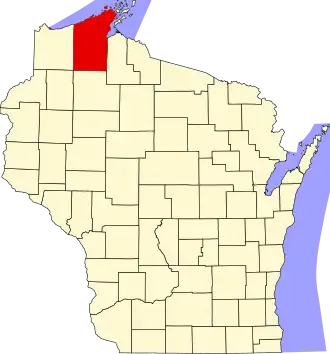
Bayfield County
| County in de Verenigde Staten | |||
|---|---|---|---|
| |||
| Situering | |||
| Staat | Wisconsin | ||
| Tijdzone | Central Standard Time (UTC−6) | ||
| Coördinaten | 46°37'48"NB, 91°10'48"WL | ||
| Algemeen | |||
| Oppervlakte | 5.287 km² | ||
| - land | 3.823 km² | ||
| - water | 1.464 km² | ||
| Inwoners (2000) |
15.013 (4 inw./km²) | ||
| Overig | |||
| Zetel | Washburn | ||
| FIPS-code | 55007 | ||
| Opgericht | 1835 | ||
| Website | www | ||
| Foto's | |||

| |||
 Bevolkingspiramide Bayfield County | |||
| Statistieken volkstelling Bayfield County | |||
| |||
Bayfield County is een van de 72 county's in de Amerikaanse staat Wisconsin.
De county heeft een landoppervlakte van 3.823 km² en telt 15.013 inwoners (volkstelling 2000). De hoofdplaats is Washburn.
Bevolkingsontwikkeling
| Jaar | Inwoners | % ± | |
|---|---|---|---|
| 1900 | 14.392 | — | |
| 1910 | 15.987 | 11,1% | |
| 1920 | 17.201 | 7,6% | |
| 1930 | 15.006 | −12,8% | |
| 1940 | 15.827 | 5,5% | |
| 1950 | 13.760 | −13,1% | |
| 1960 | 11.910 | −13,4% | |
| 1970 | 11.683 | −1,9% | |
| 1980 | 13.822 | 18,3% | |
| 1990 | 14.008 | 1,3% | |
| 2000 | 15.013 | 7,2% | |
| Bron: (en) Historical Decennial Census Population | |||
