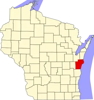
Manitowoc County
| County in de Verenigde Staten | |||
|---|---|---|---|
| |||
| Situering | |||
| Staat | Wisconsin | ||
| Tijdzone | Central Standard Time (UTC−6) | ||
| Coördinaten | 44°9'NB, 87°33'WL | ||
| Algemeen | |||
| Oppervlakte | 3.869 km² | ||
| - land | 1.532 km² | ||
| - water | 2.337 km² | ||
| Inwoners (2000) |
82.887 (54 inw./km²) | ||
| Overig | |||
| Zetel | Manitowoc | ||
| FIPS-code | 55071 | ||
| Opgericht | 1836 | ||
| Website | www | ||
| Foto's | |||
 Bevolkingspiramide Manitowoc County | |||
| Statistieken volkstelling Manitowoc County | |||
| |||
Manitowoc County is een van de 72 county's in de Amerikaanse staat Wisconsin.
De county heeft een landoppervlakte van 1.532 km² en telt 82.887 inwoners (volkstelling 2000). De hoofdplaats is Manitowoc.
Bevolkingsontwikkeling
| Jaar | Inwoners | % ± | |
|---|---|---|---|
| 1900 | 42.261 | — | |
| 1910 | 44.978 | 6,4% | |
| 1920 | 51.644 | 14,8% | |
| 1930 | 58.674 | 13,6% | |
| 1940 | 61.617 | 5,0% | |
| 1950 | 67.159 | 9,0% | |
| 1960 | 75.215 | 12,0% | |
| 1970 | 82.294 | 9,4% | |
| 1980 | 82.918 | 0,8% | |
| 1990 | 80.421 | −3,0% | |
| 2000 | 82.887 | 3,1% | |
| 2010 | 81.442 | −1,7% | |
| Bron: (en) Historical Decennial Census Population | |||