Marinette County
| County in de Verenigde Staten | |||
|---|---|---|---|
| |||
| Situering | |||
| Staat | Wisconsin | ||
| Tijdzone | Central Standard Time (UTC−6) | ||
| Coördinaten | 45°20'24"NB, 88°0'0"WL | ||
| Algemeen | |||
| Oppervlakte | 4.015 km² | ||
| - land | 3.631 km² | ||
| - water | 384 km² | ||
| Inwoners (2000) |
43.384 (12 inw./km²) | ||
| Overig | |||
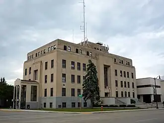
| Zetel | Marinette | ||
| FIPS-code | 55075 | ||
| Opgericht | 1879 | ||
| Website | www | ||
| Foto's | |||
| |||
 Bevolkingspiramide Marinette County | |||
| Statistieken volkstelling Marinette County | |||
| |||
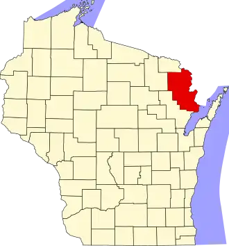
Marinette County is een van de 72 county's in de Amerikaanse staat Wisconsin.
De county heeft een landoppervlakte van 3.631 km² en telt 43.384 inwoners (volkstelling 2000). De hoofdplaats is Marinette.
Bevolkingsontwikkeling
| Jaar | Inwoners | % ± | |
|---|---|---|---|
| 1900 | 30.822 | — | |
| 1910 | 33.812 | 9,7% | |
| 1920 | 34.361 | 1,6% | |
| 1930 | 33.530 | −2,4% | |
| 1940 | 36.225 | 8,0% | |
| 1950 | 35.748 | −1,3% | |
| 1960 | 34.660 | −3,0% | |
| 1970 | 35.810 | 3,3% | |
| 1980 | 39.314 | 9,8% | |
| 1990 | 40.548 | 3,1% | |
| 2000 | 43.384 | 7,0% | |
| Bron: (en) Historical Decennial Census Population | |||