Polk County (Iowa)
| County in de Verenigde Staten | |||
|---|---|---|---|
| |||
| Situering | |||
| Staat | Iowa | ||
| Coördinaten | 41°41'6"NB, 93°34'13"WL | ||
| Algemeen | |||
| Oppervlakte | 1.533 km² | ||
| - land | 1.475 km² | ||
| - water | 58 km² | ||
| Inwoners (2000) |
374.601 (254 inw./km²) | ||
| Overig | |||
| Zetel | Des Moines | ||
| FIPS-code | 19153 | ||
| Opgericht | 1846 | ||
| Website | www | ||
| Foto's | |||

| |||
 Bevolkingspiramide Polk County | |||
| Statistieken volkstelling Polk County | |||
| |||
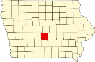
Polk County is een county in de Amerikaanse staat Iowa.
De county heeft een landoppervlakte van 1.475 km² en telt 374.601 inwoners (volkstelling 2000). De hoofdplaats is Des Moines, dat tegelijk ook de hoofdstad van Iowa is.
Bevolkingsontwikkeling
| Jaar | Inwoners | % ± | |
|---|---|---|---|
| 1900 | 82.624 | — | |
| 1910 | 110.438 | 33,7% | |
| 1920 | 154.029 | 39,5% | |
| 1930 | 172.837 | 12,2% | |
| 1940 | 195.835 | 13,3% | |
| 1950 | 226.010 | 15,4% | |
| 1960 | 266.315 | 17,8% | |
| 1970 | 286.101 | 7,4% | |
| 1980 | 303.170 | 6,0% | |
| 1990 | 327.140 | 7,9% | |
| 2000 | 374.601 | 14,5% | |
| Bron: (en) Historical Decennial Census Population | |||
De hoofdstad is Des Moines.
Steden en dorpen
- Alleman
- Altoona
- Ankeny
- Berwick
- Bondurant
- Carlisle
- Clive
- Des Moines
- Elkhart
- Grimes
- Johnston
- Mitchellville
- Pleasant Hill
- Polk City
- Runnells
- Saylorville
- Urbandale
- West Des Moines
- Windsor Heights
Polk County telt ook verschillende townships, waaronder Bloomfield Township.