Benton County (Iowa)
| County in de Verenigde Staten | |||
|---|---|---|---|
| |||
| Situering | |||
| Staat | Iowa | ||
| Coördinaten | 42°4'47"NB, 92°4'3"WL | ||
| Algemeen | |||
| Oppervlakte | 1.860 km² | ||
| - land | 1.855 km² | ||
| - water | 5 km² | ||
| Inwoners (2000) |
25.308 (14 inw./km²) | ||
| Overig | |||
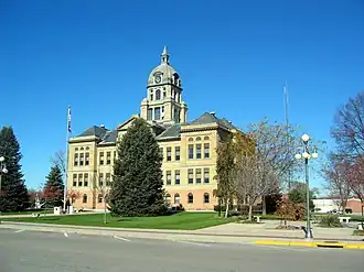
| Zetel | Vinton | ||
| FIPS-code | 19011 | ||
| Opgericht | 1837 | ||
| Website | www | ||
| Foto's | |||
| |||
 Bevolkingspiramide Benton County | |||
| Statistieken volkstelling Benton County | |||
| |||
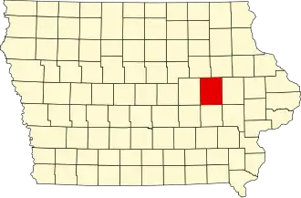
Benton County is een county in de Amerikaanse staat Iowa.
De county heeft een landoppervlakte van 1.855 km² en telt 25.308 inwoners (volkstelling 2000). De hoofdplaats en hoofdstad is Vinton.
Steden en dorpen
- Atkins
- Belle Plaine
- Blairstown
- Garrison
- Keystone
- Luzerne
- Mount Auburn
- Newhall
- Norway
- Shellsburg
- Urbana
- Van Horne
- Vinton
- Walford
Bevolkingsontwikkeling
| Jaar | Inwoners | % ± | |
|---|---|---|---|
| 1900 | 25.177 | — | |
| 1910 | 23.156 | −8,0% | |
| 1920 | 24.080 | 4,0% | |
| 1930 | 22.851 | −5,1% | |
| 1940 | 22.879 | 0,1% | |
| 1950 | 22.656 | −1,0% | |
| 1960 | 23.422 | 3,4% | |
| 1970 | 22.885 | −2,3% | |
| 1980 | 23.649 | 3,3% | |
| 1990 | 22.429 | −5,2% | |
| 2000 | 25.308 | 12,8% | |
| Bron: (en) Historical Decennial Census Population | |||