Westmoreland County (Pennsylvania)
| County in de Verenigde Staten | |||
|---|---|---|---|
| |||
| Situering | |||
| Staat | Pennsylvania | ||
| Tijdzone | Eastern Standard Time (UTC−5) | ||
| Coördinaten | 40°18'36"NB, 79°28'12"WL | ||
| Algemeen | |||
| Oppervlakte | 2.684 km² | ||
| - land | 2.656 km² | ||
| - water | 28 km² | ||
| Inwoners (2000) |
369.993 (139 inw./km²) | ||
| Overig | |||
| Zetel | Greensburg | ||
| FIPS-code | 42129 | ||
| Opgericht | 1773 | ||
| Website | www | ||
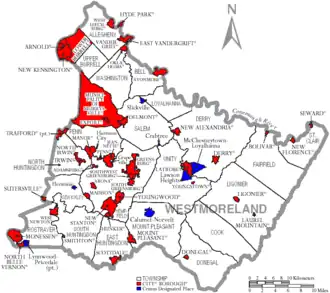
| Detailkaart | |||
| |||
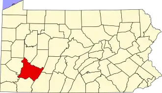
| Overzichtskaart van Westmoreland County | |||
| Foto's | |||

| |||
 Bevolkingspiramide Westmoreland County | |||
| Statistieken volkstelling Westmoreland County | |||
| |||
Westmoreland County is een van de 67 county's in de Amerikaanse staat Pennsylvania.
De county heeft een landoppervlakte van 2.656 km² en telt 369.993 inwoners (volkstelling 2000). De hoofdplaats is Greensburg.
Bevolkingsontwikkeling
| Jaar | Inwoners | % ± | |
|---|---|---|---|
| 1900 | 160.175 | — | |
| 1910 | 231.304 | 44,4% | |
| 1920 | 273.568 | 18,3% | |
| 1930 | 294.995 | 7,8% | |
| 1940 | 303.411 | 2,9% | |
| 1950 | 313.179 | 3,2% | |
| 1960 | 352.629 | 12,6% | |
| 1970 | 376.935 | 6,9% | |
| 1980 | 392.294 | 4,1% | |
| 1990 | 370.321 | −5,6% | |
| 2000 | 369.993 | −0,1% | |
| Bron: (en) Historical Decennial Census Population | |||