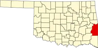
Le Flore County
| County in de Verenigde Staten | |||
|---|---|---|---|
| |||
| Situering | |||
| Staat | Oklahoma | ||
| Tijdzone | Central Standard Time (UTC−6) | ||
| Coördinaten | 34°54'NB, 94°42'WL | ||
| Algemeen | |||
| Oppervlakte | 4.164 km² | ||
| - land | 4.107 km² | ||
| - water | 57 km² | ||
| Inwoners (2000) |
48.109 (12 inw./km²) | ||
| Overig | |||
| Zetel | Poteau | ||
| FIPS-code | 40079 | ||
| Opgericht | 1907 | ||
| Foto's | |||

| |||
 Bevolkingspiramide Le Flore County | |||
| Statistieken volkstelling Le Flore County | |||
| |||
Le Flore County is een van de 77 county's in de Amerikaanse staat Oklahoma.
De county heeft een landoppervlakte van 4.107 km² en telt 48.109 inwoners (volkstelling 2000). De hoofdplaats is Poteau.