Coal County
| County in de Verenigde Staten | |||
|---|---|---|---|
| |||
| Situering | |||
| Staat | Oklahoma | ||
| Tijdzone | Central Standard Time (UTC−6) | ||
| Coördinaten | 34°36'NB, 96°18'WL | ||
| Algemeen | |||
| Oppervlakte | 1.350 km² | ||
| - land | 1.342 km² | ||
| - water | 8 km² | ||
| Inwoners (2000) |
6.031 (4 inw./km²) | ||
| Overig | |||
| Zetel | Coalgate | ||
| FIPS-code | 40029 | ||
| Opgericht | 1907 | ||
| Website | coal | ||
| Foto's | |||
| |||
 Bevolkingspiramide Coal County | |||
| Statistieken volkstelling Coal County | |||
| |||
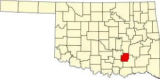
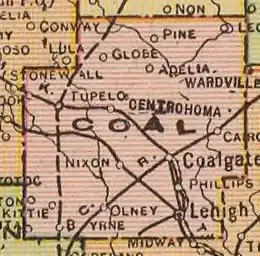
Coal County is een van de 77 county's in de Amerikaanse staat Oklahoma.
De county heeft een landoppervlakte van 1.342 km² en telt 6.031 inwoners (volkstelling 2000). De hoofdplaats is Coalgate.
Zie de categorie Coal County, Oklahoma van Wikimedia Commons voor mediabestanden over dit onderwerp.