Garfield County (Oklahoma)
| County in de Verenigde Staten | |||
|---|---|---|---|
| |||
| Situering | |||
| Staat | Oklahoma | ||
| Tijdzone | Central Standard Time (UTC−6) | ||
| Coördinaten | 36°22'48"NB, 97°46'48"WL | ||
| Algemeen | |||
| Oppervlakte | 2.745 km² | ||
| - land | 2.741 km² | ||
| - water | 4 km² | ||
| Inwoners (2000) |
57.813 (21 inw./km²) | ||
| Overig | |||
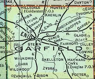
| Zetel | Enid | ||
| FIPS-code | 40047 | ||
| Opgericht | 1893 | ||
| Website | www | ||
| Foto's | |||

| |||
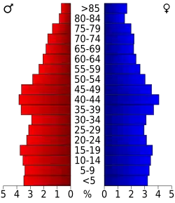 Bevolkingspiramide Garfield County | |||
| Statistieken volkstelling Garfield County | |||
| |||
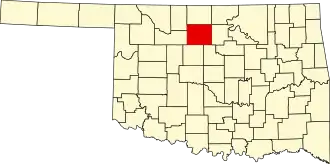
Garfield County is een van de 77 county's in de Amerikaanse staat Oklahoma.
De county heeft een landoppervlakte van 2.741 km² en telt 57.813 inwoners (volkstelling 2000). De hoofdplaats is Enid.
Bevolkingsontwikkeling
| Jaar | Inwoners | % ± | |
|---|---|---|---|
| 1900 | 22.076 | — | |
| 1910 | 33.050 | 49,7% | |
| 1920 | 37.500 | 13,5% | |
| 1930 | 45.588 | 21,6% | |
| 1940 | 45.484 | −0,2% | |
| 1950 | 52.820 | 16,1% | |
| 1960 | 52.975 | 0,3% | |
| 1970 | 55.365 | 4,5% | |
| 1980 | 62.820 | 13,5% | |
| 1990 | 56.735 | −9,7% | |
| 2000 | 57.813 | 1,9% | |
| Bron: (en) Historical Decennial Census Population | |||