Vinton County
| County in de Verenigde Staten | |||
|---|---|---|---|
| |||
| Situering | |||
| Staat | Ohio | ||
| Tijdzone | Eastern Standard Time (UTC−5) | ||
| Coördinaten | 39°15'0"NB, 82°29'24"WL | ||
| Algemeen | |||
| Oppervlakte | 1.074 km² | ||
| - land | 1.072 km² | ||
| - water | 2 km² | ||
| Inwoners (2000) |
12.806 (12 inw./km²) | ||
| Overig | |||
| Zetel | McArthur | ||
| FIPS-code | 39163 | ||
| Opgericht | 1850 | ||
| Website | co | ||
| Detailkaart | |||
| |||
| Overzichtskaart van Vinton County | |||
| Foto's | |||

| |||
 Bevolkingspiramide Vinton County | |||
| Statistieken volkstelling Vinton County | |||
| |||
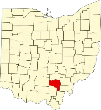
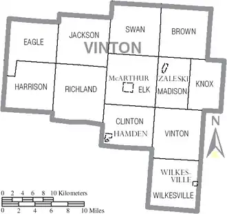
Vinton County is een van de 88 county's in de Amerikaanse staat Ohio.
De county heeft een landoppervlakte van 1.072 km² en telt 12.806 inwoners (volkstelling 2000). De hoofdplaats is McArthur.
Bevolkingsontwikkeling
| Jaar | Inwoners | % ± | |
|---|---|---|---|
| 1900 | 15.330 | — | |
| 1910 | 13.096 | −14,6% | |
| 1920 | 12.075 | −7,8% | |
| 1930 | 10.287 | −14,8% | |
| 1940 | 11.573 | 12,5% | |
| 1950 | 10.759 | −7,0% | |
| 1960 | 10.274 | −4,5% | |
| 1970 | 9.420 | −8,3% | |
| 1980 | 11.584 | 23,0% | |
| 1990 | 11.098 | −4,2% | |
| 2000 | 12.806 | 15,4% | |
| Bron: (en) Historical Decennial Census Population | |||