Coshocton County
| County in de Verenigde Staten | |||
|---|---|---|---|
| |||
| Situering | |||
| Staat | Ohio | ||
| Tijdzone | Eastern Standard Time (UTC−5) | ||
| Coördinaten | 40°18'0"NB, 81°55'12"WL | ||
| Algemeen | |||
| Oppervlakte | 1.470 km² | ||
| - land | 1.461 km² | ||
| - water | 9 km² | ||
| Inwoners (2000) |
36.655 (25 inw./km²) | ||
| Overig | |||
| Zetel | Coshocton | ||
| FIPS-code | 39031 | ||
| Opgericht | 1810 | ||
| Website | www | ||
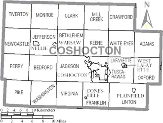
| Detailkaart | |||
| |||
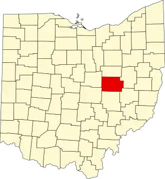
| Overzichtskaart van Coshocton County | |||
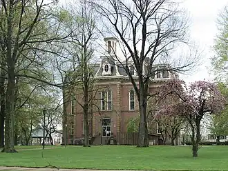
| Foto's | |||
| |||
 Bevolkingspiramide Coshocton County | |||
| Statistieken volkstelling Coshocton County | |||
| |||
Coshocton County is een van de 88 county's in de Amerikaanse staat Ohio.
De county heeft een landoppervlakte van 1.461 km² en telt 36.655 inwoners (volkstelling 2000). De hoofdplaats is Coshocton.
Bevolkingsontwikkeling
| Jaar | Inwoners | % ± | |
|---|---|---|---|
| 1900 | 29.337 | — | |
| 1910 | 30.121 | 2,7% | |
| 1920 | 29.595 | −1,7% | |
| 1930 | 28.976 | −2,1% | |
| 1940 | 30.594 | 5,6% | |
| 1950 | 31.141 | 1,8% | |
| 1960 | 32.224 | 3,5% | |
| 1970 | 33.486 | 3,9% | |
| 1980 | 36.024 | 7,6% | |
| 1990 | 35.427 | −1,7% | |
| 2000 | 36.655 | 3,5% | |
| Bron: (en) Historical Decennial Census Population | |||