Ashland County (Ohio)
| County in de Verenigde Staten | |||
|---|---|---|---|
| |||
| Situering | |||
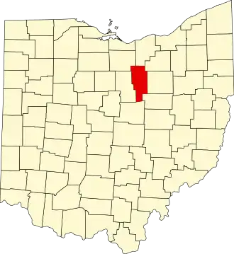
| Staat | Ohio | ||
| Tijdzone | Eastern Standard Time (UTC−5) | ||
| Coördinaten | 40°50'24"NB, 82°16'12"WL | ||
| Algemeen | |||
| Oppervlakte | 1.105 km² | ||
| - land | 1.099 km² | ||
| - water | 6 km² | ||
| Inwoners (2000) |
52.523 (48 inw./km²) | ||
| Overig | |||
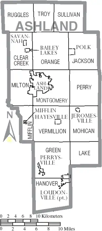
| Zetel | Ashland | ||
| FIPS-code | 39005 | ||
| Opgericht | 1846 | ||
| Website | www | ||
| Detailkaart | |||
| |||
| Overzichtskaart van Ashland County | |||
| Foto's | |||

| |||
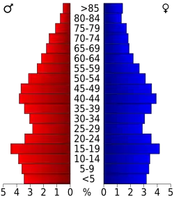 Bevolkingspiramide Ashland County | |||
| Statistieken volkstelling Ashland County | |||
| |||
Ashland County is een van de 88 county's in de Amerikaanse staat Ohio.
De county heeft een landoppervlakte van 1.099 km² en telt 52.523 inwoners (volkstelling 2000). De hoofdplaats is Ashland.
Bevolkingsontwikkeling
| Jaar | Inwoners | % ± | |
|---|---|---|---|
| 1900 | 21.184 | — | |
| 1910 | 22.975 | 8,5% | |
| 1920 | 24.627 | 7,2% | |
| 1930 | 26.867 | 9,1% | |
| 1940 | 29.785 | 10,9% | |
| 1950 | 33.040 | 10,9% | |
| 1960 | 38.771 | 17,3% | |
| 1970 | 43.303 | 11,7% | |
| 1980 | 46.178 | 6,6% | |
| 1990 | 47.507 | 2,9% | |
| 2000 | 52.523 | 10,6% | |
| Bron: (en) Historical Decennial Census Population | |||