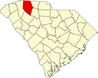
Spartanburg County
| County in de Verenigde Staten | |||
|---|---|---|---|
| |||
| Situering | |||
| Staat | South Carolina | ||
| Coördinaten | 34°55'48"NB, 81°59'24"WL | ||
| Algemeen | |||
| Oppervlakte | 2.121 km² | ||
| - land | 2.100 km² | ||
| - water | 21 km² | ||
| Inwoners (2000) |
253.791 (121 inw./km²) | ||
| Overig | |||
| Zetel | Spartanburg | ||
| FIPS-code | 45083 | ||
| Opgericht | 1785 | ||
| Website | www | ||
| Foto's | |||

| |||
 Bevolkingspiramide Spartanburg County | |||
| Statistieken volkstelling Spartanburg County | |||
| |||
Spartanburg County is een van de 46 county's in de Amerikaanse staat South Carolina.
De county heeft een landoppervlakte van 2.100 km² en telt 253.791 inwoners (volkstelling 2000). De hoofdplaats is Spartanburg.
Bevolkingsontwikkeling
| Jaar | Inwoners | % ± | |
|---|---|---|---|
| 1900 | 65.560 | — | |
| 1910 | 83.465 | 27,3% | |
| 1920 | 94.265 | 12,9% | |
| 1930 | 116.323 | 23,4% | |
| 1940 | 127.733 | 9,8% | |
| 1950 | 150.349 | 17,7% | |
| 1960 | 156.830 | 4,3% | |
| 1970 | 173.724 | 10,8% | |
| 1980 | 201.861 | 16,2% | |
| 1990 | 226.800 | 12,4% | |
| 2000 | 253.791 | 11,9% | |
| Bron: (en) Historical Decennial Census Population | |||