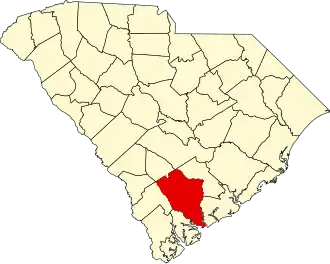
Colleton County
| County in de Verenigde Staten | |||
|---|---|---|---|
| |||
| Situering | |||
| Staat | South Carolina | ||
| Coördinaten | 32°50'24"NB, 80°39'0"WL | ||
| Algemeen | |||
| Oppervlakte | 2.935 km² | ||
| - land | 2.736 km² | ||
| - water | 199 km² | ||
| Inwoners (2000) |
38.264 (14 inw./km²) | ||
| Overig | |||
| Zetel | Walterboro | ||
| FIPS-code | 45029 | ||
| Opgericht | 1798 | ||
| Website | www | ||
| Foto's | |||

| |||
 Bevolkingspiramide Colleton County | |||
| Statistieken volkstelling Colleton County | |||
| |||
Colleton County is een van de 46 county's in de Amerikaanse staat South Carolina.
De county heeft een landoppervlakte van 2.736 km² en telt 38.264 inwoners (volkstelling 2000). De hoofdplaats is Walterboro.
Bevolkingsontwikkeling
| Jaar | Inwoners | % ± | |
|---|---|---|---|
| 1900 | 33.452 | — | |
| 1910 | 35.390 | 5,8% | |
| 1920 | 29.897 | −15,5% | |
| 1930 | 25.821 | −13,6% | |
| 1940 | 26.268 | 1,7% | |
| 1950 | 28.242 | 7,5% | |
| 1960 | 27.816 | −1,5% | |
| 1970 | 27.622 | −0,7% | |
| 1980 | 31.776 | 15,0% | |
| 1990 | 34.377 | 8,2% | |
| 2000 | 38.264 | 11,3% | |
| Bron: (en) Historical Decennial Census Population | |||