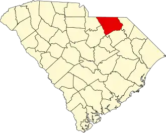
Chesterfield County (South Carolina)
| County in de Verenigde Staten | |||
|---|---|---|---|
| |||
| Situering | |||
| Staat | South Carolina | ||
| Coördinaten | 34°38'24"NB, 80°9'36"WL | ||
| Algemeen | |||
| Oppervlakte | 2.087 km² | ||
| - land | 2.068 km² | ||
| - water | 19 km² | ||
| Inwoners (2000) |
42.768 (21 inw./km²) | ||
| Overig | |||
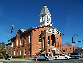
| Zetel | Chesterfield | ||
| FIPS-code | 45025 | ||
| Opgericht | 1798 | ||
| Website | www | ||
| Foto's | |||
| |||
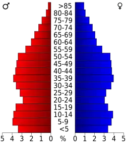 Bevolkingspiramide Chesterfield County | |||
| Statistieken volkstelling Chesterfield County | |||
| |||
Chesterfield County is een van de 46 county's in de Amerikaanse staat South Carolina.
De county heeft een landoppervlakte van 2.068 km² en telt 42.768 inwoners (volkstelling 2000). De hoofdplaats is Chesterfield.
Bevolkingsontwikkeling
| Jaar | Inwoners | % ± | |
|---|---|---|---|
| 1900 | 20.401 | — | |
| 1910 | 26.301 | 28,9% | |
| 1920 | 31.969 | 21,6% | |
| 1930 | 34.334 | 7,4% | |
| 1940 | 35.963 | 4,7% | |
| 1950 | 36.236 | 0,8% | |
| 1960 | 33.717 | −7,0% | |
| 1970 | 33.667 | −0,1% | |
| 1980 | 38.161 | 13,3% | |
| 1990 | 38.577 | 1,1% | |
| 2000 | 42.768 | 10,9% | |
| Bron: (en) Historical Decennial Census Population | |||