Rose Ash
| Civil parish in Engeland | |||
|---|---|---|---|
 | |||
| Situering | |||
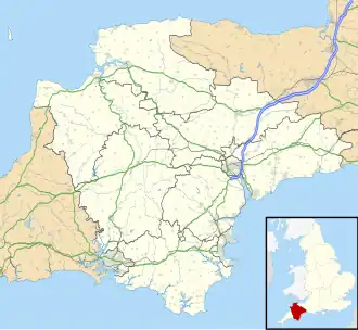
| Regio | South West England | ||
| Graafschap | Devon | ||
| District | North Devon | ||
| Coördinaten | 50° 59' NB, 3° 44' WL | ||
| Algemeen | |||
| Oppervlakte | 20,4465 km² | ||
| Inwoners (2011) |
298 (15 inw./km²) | ||
| Overig | |||
| ONS-code | E04003115 | ||
| Foto's | |||
| |||
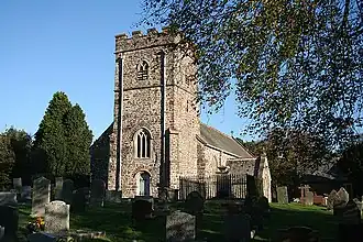
| St.-Petruskerk. | |||
| |||
Rose Ash of Ralph-Esse[1][2][3] is een civil parish in het bestuurlijke gebied North Devon, in het Engelse graafschap Devon. In 2001 telde het civil parish 294 inwoners.[4] Rose Ash komt in het Domesday Book (1086) voor als 'Aisse' / 'Aissa'.[5] De parish omvat de gehucht Ash Moor.[6]
Bronnen
- ↑ http://www.visionofbritain.org.uk/place/place_page.jsp?p_id=3212
- ↑ https://web.archive.org/web/20120902000625/http://genuki.cs.ncl.ac.uk/DEV/RoseAsh/index.html
- ↑ http://www.uk-genealogy.org.uk/england/Devon/towns/RoseAsh.html
- ↑ Neighbourhood Statistics
- ↑ http://www.domesdaybook.co.uk/devonshire5.html#roseash
- ↑ envelope printMap
Externe links
- https://web.archive.org/web/20140419015841/http://www.roseashdevon.co.uk/
- http://www.loosemore.co.uk/Chapter8/CHAPTER8text.htm