Huntshaw
| Civil parish in Engeland | |||
|---|---|---|---|
 | |||
| Situering | |||
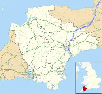
| Regio | South West England | ||
| Graafschap | Devon | ||
| District | Torridge | ||
| Coördinaten | 50° 59' NB, 4° 8' WL | ||
| Algemeen | |||
| Oppervlakte | 8,4113 km² | ||
| Inwoners (2011) |
134 (16 inw./km²) | ||
| Overig | |||
| ONS-code | E04003271 | ||
| Foto's | |||
| |||
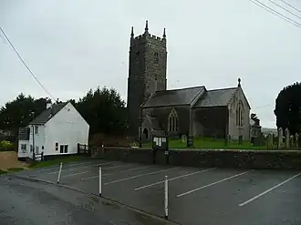
| St. Mary Magdelene's church | |||
| |||
Huntshaw of Hunshaw[1] is een civil parish in het bestuurlijke gebied Torridge, in het Engelse graafschap Devon. In 2001 telde het civil parish 120 inwoners.[2] Huntshaw komt in het Domesday Book (1086) voor als 'Huneseue / Huneseua'.[3] De civil parish telt 9 monumentale panden.[4]
Bronnen
- ↑ Genuki. Gearchiveerd op 26 januari 2012. Geraadpleegd op 1 april 2012.
- ↑ Neighbourhood Statistics
- ↑ The Domesday Book online
- ↑ Listed Buildings in Huntshaw, Devon, England
Externe links
- History of Huntshaw Huntshawbarton.com
- Devon County Council