Otero County (New Mexico)
| County in de Verenigde Staten | |||
|---|---|---|---|
| |||
| Situering | |||
| Staat | New Mexico | ||
| Coördinaten | 32°37'12"NB, 105°43'48"WL | ||
| Algemeen | |||
| Oppervlakte | 17.165 km² | ||
| - land | 17.163 km² | ||
| - water | 2 km² | ||
| Inwoners (2000) |
62.298 (4 inw./km²) | ||
| Overig | |||
| Zetel | Alamogordo | ||
| FIPS-code | 35035 | ||
| Website | co | ||
| Foto's | |||

| |||
 Bevolkingspiramide Otero County | |||
| Statistieken volkstelling Otero County | |||
| |||
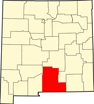
Otero County is een county in de Amerikaanse staat New Mexico.
De county heeft een landoppervlakte van 17.163 km² en telt 62.298 inwoners (volkstelling 2000). De hoofdplaats is Alamogordo.
Bevolkingsontwikkeling
| Jaar | Inwoners | % ± | |
|---|---|---|---|
| 1900 | 4.791 | — | |
| 1910 | 7.069 | 47,5% | |
| 1920 | 7.902 | 11,8% | |
| 1930 | 9.779 | 23,8% | |
| 1940 | 10.522 | 7,6% | |
| 1950 | 14.909 | 41,7% | |
| 1960 | 36.976 | 148,0% | |
| 1970 | 41.097 | 11,1% | |
| 1980 | 44.665 | 8,7% | |
| 1990 | 51.928 | 16,3% | |
| 2000 | 62.298 | 20,0% | |
| Bron: (en) Historical Decennial Census Population | |||