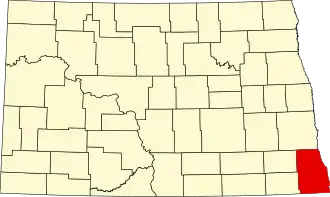
Richland County (North Dakota)
| County in de Verenigde Staten | |||
|---|---|---|---|
| |||
| Situering | |||
| Staat | North Dakota | ||
| Tijdzone | Central Standard Time (UTC−6) | ||
| Coördinaten | 46°16'12"NB, 96°57'0"WL | ||
| Algemeen | |||
| Oppervlakte | 3.744 km² | ||
| - land | 3.721 km² | ||
| - water | 23 km² | ||
| Inwoners (2000) |
17.998 (5 inw./km²) | ||
| Overig | |||
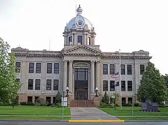
| Zetel | Wahpeton | ||
| FIPS-code | 38077 | ||
| Opgericht | 1873 | ||
| Website | www | ||
| Foto's | |||
| |||
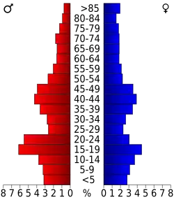 Bevolkingspiramide Richland County | |||
| Statistieken volkstelling Richland County | |||
| |||
Richland County is een county in de Amerikaanse staat North Dakota.
De county heeft een landoppervlakte van 3.721 km² en telt 17.998 inwoners (volkstelling 2000). De hoofdplaats is Wahpeton.