LaMoure County
| County in de Verenigde Staten | |||
|---|---|---|---|
| |||
| Situering | |||
| Staat | North Dakota | ||
| Tijdzone | Central Standard Time (UTC−6) | ||
| Coördinaten | 46°28'12"NB, 98°31'48"WL | ||
| Algemeen | |||
| Oppervlakte | 2.980 km² | ||
| - land | 2.971 km² | ||
| - water | 9 km² | ||
| Inwoners (2000) |
4.701 (2 inw./km²) | ||
| Overig | |||
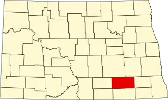
| Zetel | LaMoure | ||
| FIPS-code | 38045 | ||
| Opgericht | 1873 | ||
| Website | www | ||
| Foto's | |||

| |||
 Bevolkingspiramide LaMoure County | |||
| Statistieken volkstelling LaMoure County | |||
| |||
LaMoure County is een county in de Amerikaanse staat North Dakota.
De county heeft een landoppervlakte van 2.971 km² en telt 4.701 inwoners (volkstelling 2000). De hoofdplaats is LaMoure.
Bevolkingsontwikkeling
| Jaar | Inwoners | % ± | |
|---|---|---|---|
| 1900 | 6.048 | — | |
| 1910 | 10.724 | 77,3% | |
| 1920 | 11.564 | 7,8% | |
| 1930 | 11.517 | −0,4% | |
| 1940 | 10.298 | −10,6% | |
| 1950 | 9.498 | −7,8% | |
| 1960 | 8.705 | −8,3% | |
| 1970 | 7.117 | −18,2% | |
| 1980 | 6.473 | −9,0% | |
| 1990 | 5.383 | −16,8% | |
| 2000 | 4.701 | −12,7% | |
| Bron: (en) Historical Decennial Census Population | |||