South Ayrshire
| Raadsgebied van Schotland | |||
|---|---|---|---|
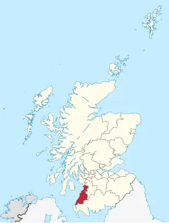 Ligging van South Ayrshire in Schotland | |||
| Coördinaten | 55°17'0"NB, 4°42'0"WL | ||
| Algemeen | |||
| Oppervlakte | 1221,9719[1] km² | ||
| Hoofdplaats | Ayr | ||
| - rang | 15e | ||
| Inwoners (2017) | 112.550 (92 inw./km²) | ||
| Politiek | |||
| Bestuur | |||
| MP's | Brian Donohoe, Sandra Osborne | ||
| MSP's | Cathy Jamieson, John Scott | ||
| Overig | |||
| ONS code | S12000028 | ||
| ISO 3166 | GB-SAY | ||
| Website | south-ayrshire.gov.uk | ||
| |||
South Ayrshire (Schots-Gaelisch: Siorrachd Inbhir Àir a Deas) is een raadsgebied (council area) in het zuidwesten van Schotland met een oppervlakte van 1222 km². De hoofdplaats is Ayr en het raadsgebied heeft 112.550 inwoners (2017).
Het raadsgebied behoort tot de lieutenancy area Ayrshire and Arran en het historische graafschap Ayrshire.
Plaatsen
- Alloway
- Ayr
- Annbank
- Ballantrae
- Barr
- Barrhill
- Crosshill
- Coylton
- Drongan
- Dailly
- Dalrymple
- Dundonald
- Doonfoot
- Dunure
- Girvan
- Kirkmichael
- Kirkoswald
- Lendalfoot
- Maybole
- Monkton
- Mossblown
- Maidens
- Old Dailly
- Pinmore & Pinwherry
- Prestwick
- Straiton
- Symington
- Tarbolton
- Troon
- Turnberry
Bezienswaardigheden
- Baltersan Castle
- Crossraguel Abbey
- Culzean Castle
- Dundonald Castle
- Maybole Collegiate Church
- Thomaston Castle
Bronnen, noten en/of referenties