East Ayrshire
| Raadsgebied van Schotland | |||
|---|---|---|---|
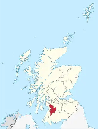 Ligging van East Ayrshire in Schotland | |||
| Coördinaten | 55°30'NB, 4°15'WL | ||
| Algemeen | |||
| Oppervlakte | 1262,1276[1] km² | ||
| Hoofdplaats | Kilmarnock | ||
| - rang | 14e | ||
| Inwoners (2017) | 121.840 (97 inw./km²) | ||
| Politiek | |||
| Bestuur | |||
| MP's | Des Browne, Sandra Osborne | ||
| MSP's | Willie Coffey, Cathy Jamieson | ||
| Overig | |||
| ONS code | S12000008 | ||
| ISO 3166 | GB-EAY | ||
| Website | east-ayrshire.gov.uk | ||
| |||
East Ayrshire (Schots-Gaelisch: Siorrachd Inbhir Àir an Ear) is een raadsgebied (council area) in het zuidwesten van Schotland met een oppervlakte van 1262 km². De hoofdplaats is Kilmarnock en het raadsgebied heeft 121.840 inwoners (2017).
Het raadsgebied behoort tot de lieutenancy area Ayrshire and Arran en het historische graafschap Ayrshire.
Plaatsen
- Cumnock
- Galston
- Kilmarnock
- Stewarton
Bronnen, noten en/of referenties
Zie de categorie East Ayrshire van Wikimedia Commons voor mediabestanden over dit onderwerp.