Ripley County (Missouri)
| County in de Verenigde Staten | |||
|---|---|---|---|
| |||
| Situering | |||
| Staat | Missouri | ||
| Coördinaten | 36°39'36"NB, 90°52'12"WL | ||
| Algemeen | |||
| Oppervlakte | 1.636 km² | ||
| - land | 1.630 km² | ||
| - water | 6 km² | ||
| Inwoners (2000) |
13.509 (8 inw./km²) | ||
| Overig | |||
| Zetel | Doniphan | ||
| FIPS-code | 29181 | ||
| Opgericht | 1833 | ||
| Website | www | ||
| Foto's | |||

| |||
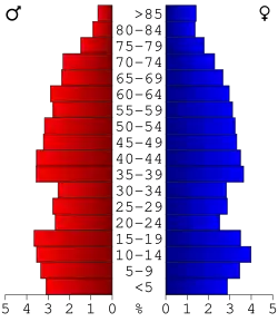 Bevolkingspiramide Ripley County | |||
| Statistieken volkstelling Ripley County | |||
| |||
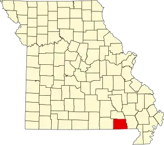
Ripley County is een county in de Amerikaanse staat Missouri.
De county heeft een landoppervlakte van 1.630 km² en telt 13.509 inwoners (volkstelling 2000). De hoofdplaats is Doniphan.
Bevolkingsontwikkeling
| Jaar | Inwoners | % ± | |
|---|---|---|---|
| 1900 | 13.186 | — | |
| 1910 | 13.099 | −0,7% | |
| 1920 | 12.061 | −7,9% | |
| 1930 | 11.176 | −7,3% | |
| 1940 | 12.606 | 12,8% | |
| 1950 | 11.414 | −9,5% | |
| 1960 | 9.096 | −20,3% | |
| 1970 | 9.803 | 7,8% | |
| 1980 | 12.458 | 27,1% | |
| 1990 | 12.303 | −1,2% | |
| 2000 | 13.509 | 9,8% | |
| Bron: (en) Historical Decennial Census Population | |||