Madison County (New York)
| County in de Verenigde Staten | |||
|---|---|---|---|
| |||
| Situering | |||
| Staat | New York | ||
| Tijdzone | Eastern Standard Time (UTC−5) | ||
| Coördinaten | 42°54'36"NB, 75°40'12"WL | ||
| Algemeen | |||
| Oppervlakte | 1.714 km² | ||
| - land | 1.699 km² | ||
| - water | 15 km² | ||
| Inwoners (2000) |
69.441 (41 inw./km²) | ||
| Overig | |||
| Zetel | Wampsville | ||
| FIPS-code | 36053 | ||
| Opgericht | 1806 | ||
| Website | www | ||
| Foto's | |||

| |||
 Bevolkingspiramide Madison County | |||
| Statistieken volkstelling Madison County | |||
| |||
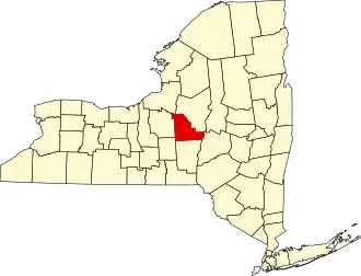
Madison County is een county in de Amerikaanse staat New York.
De county heeft een landoppervlakte van 1.699 km² en telt 69.441 inwoners (volkstelling 2000). De hoofdplaats is Wampsville. Andere plaatsen zijn onder andere Chittenango.
Bevolkingsontwikkeling
| Jaar | Inwoners | % ± | |
|---|---|---|---|
| 1900 | 40.545 | — | |
| 1910 | 39.289 | −3,1% | |
| 1920 | 39.535 | 0,6% | |
| 1930 | 39.790 | 0,6% | |
| 1940 | 39.598 | −0,5% | |
| 1950 | 46.214 | 16,7% | |
| 1960 | 54.635 | 18,2% | |
| 1970 | 62.864 | 15,1% | |
| 1980 | 65.150 | 3,6% | |
| 1990 | 69.120 | 6,1% | |
| 2000 | 69.441 | 0,5% | |
| Bron: (en) Historical Decennial Census Population | |||
Zie de categorie Madison County, New York van Wikimedia Commons voor mediabestanden over dit onderwerp.