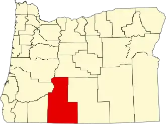
Klamath County
| County in de Verenigde Staten | |||
|---|---|---|---|
| |||
| Situering | |||
| Staat | Oregon | ||
| Tijdzone | Mountain Standard Time (UTC−7) | ||
| Coördinaten | 42°40'48"NB, 121°39'0"WL | ||
| Algemeen | |||
| Oppervlakte | 15.891 km² | ||
| - land | 15.395 km² | ||
| - water | 496 km² | ||
| Inwoners (2000) |
63.775 (4 inw./km²) | ||
| Overig | |||
| Zetel | Klamath Falls | ||
| FIPS-code | 41035 | ||
| Opgericht | 1882 | ||
| Website | www | ||
| Foto's | |||

| |||
 Bevolkingspiramide Klamath County | |||
| Statistieken volkstelling Klamath County | |||
| |||
Klamath County is een van de 36 county's in de Amerikaanse staat Oregon.
De county heeft een landoppervlakte van 15.395 km² en telt 63.775 inwoners (volkstelling 2000). De hoofdplaats is Klamath Falls.
In de county ligt de berg Mount Scott en het kratermeer Crater Lake.
Bevolkingsontwikkeling
| Jaar | Inwoners | % ± | |
|---|---|---|---|
| 1900 | 3.970 | — | |
| 1910 | 8.554 | 115,5% | |
| 1920 | 11.413 | 33,4% | |
| 1930 | 32.407 | 183,9% | |
| 1940 | 40.497 | 25,0% | |
| 1950 | 42.150 | 4,1% | |
| 1960 | 47.475 | 12,6% | |
| 1970 | 50.021 | 5,4% | |
| 1980 | 59.117 | 18,2% | |
| 1990 | 57.702 | −2,4% | |
| 2000 | 63.775 | 10,5% | |
| Bron: (en) Historical Decennial Census Population | |||