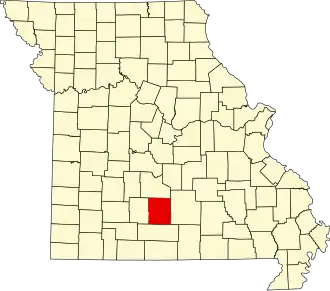
Wright County (Missouri)
| County in de Verenigde Staten | |||
|---|---|---|---|
| |||
| Situering | |||
| Staat | Missouri | ||
| Coördinaten | 37°16'12"NB, 92°27'36"WL | ||
| Algemeen | |||
| Oppervlakte | 1.770 km² | ||
| - land | 1.767 km² | ||
| - water | 3 km² | ||
| Inwoners (2000) |
17.955 (10 inw./km²) | ||
| Overig | |||
| Zetel | Hartville | ||
| FIPS-code | 29229 | ||
| Opgericht | 1861 | ||
| Website | www | ||
| Foto's | |||

| |||
 Bevolkingspiramide Wright County | |||
| Statistieken volkstelling Wright County | |||
| |||
Wright County is een county in de Amerikaanse staat Missouri.
De county heeft een landoppervlakte van 1.767 km² en telt 17.955 inwoners (volkstelling 2000). De hoofdplaats is Hartville.
Bevolkingsontwikkeling
| Jaar | Inwoners | % ± | |
|---|---|---|---|
| 1900 | 17.519 | — | |
| 1910 | 18.315 | 4,5% | |
| 1920 | 17.733 | −3,2% | |
| 1930 | 16.741 | −5,6% | |
| 1940 | 17.967 | 7,3% | |
| 1950 | 15.834 | −11,9% | |
| 1960 | 14.183 | −10,4% | |
| 1970 | 13.667 | −3,6% | |
| 1980 | 16.188 | 18,4% | |
| 1990 | 16.758 | 3,5% | |
| 2000 | 17.955 | 7,1% | |
| Bron: (en) Historical Decennial Census Population | |||