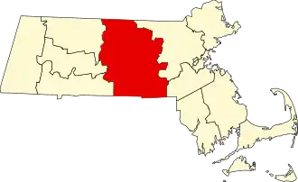
Worcester County (Massachusetts)
| County in de Verenigde Staten | |||
|---|---|---|---|
| |||
| Situering | |||
| Staat | Massachusetts | ||
| Coördinaten | 42°21'0"NB, 71°54'36"WL | ||
| Algemeen | |||
| Oppervlakte | 4.090 km² | ||
| - land | 3.919 km² | ||
| - water | 171 km² | ||
| Inwoners (2000) |
750.963 (192 inw./km²) | ||
| Overig | |||
| Zetel | Worcester | ||
| FIPS-code | 25027 | ||
| Opgericht | 1731 | ||
| Foto's | |||

| |||
 Bevolkingspiramide Worcester County | |||
| Statistieken volkstelling Worcester County | |||
| |||
Worcester County is een county in de Amerikaanse staat Massachusetts.
De county heeft een landoppervlakte van 3.919 km² en telt 750.963 inwoners (volkstelling 2000). De hoofdplaats is Worcester.
In de county ligt de berg Mount Wachusett in het gebied van Wachusett Mountain State Reservation.
Bevolkingsontwikkeling
| Jaar | Inwoners | % ± | |
|---|---|---|---|
| 1900 | 346.958 | — | |
| 1910 | 399.657 | 15,2% | |
| 1920 | 455.135 | 13,9% | |
| 1930 | 491.242 | 7,9% | |
| 1940 | 504.470 | 2,7% | |
| 1950 | 546.401 | 8,3% | |
| 1960 | 583.228 | 6,7% | |
| 1970 | 637.969 | 9,4% | |
| 1980 | 646.352 | 1,3% | |
| 1990 | 709.705 | 9,8% | |
| 2000 | 750.963 | 5,8% | |
| Bron: (en) Historical Decennial Census Population | |||
Geboren
- Eli Whitney (Westborough,1765-1825), uitvinder