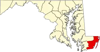
Worcester County (Maryland)
| County in de Verenigde Staten | |||
|---|---|---|---|
| |||
| Situering | |||
| Staat | Maryland | ||
| Coördinaten | 38°13'48"NB, 75°16'48"WL | ||
| Algemeen | |||
| Oppervlakte | 1.800 km² | ||
| - land | 1.226 km² | ||
| - water | 574 km² | ||
| Inwoners (2000) |
46.543 (38 inw./km²) | ||
| Overig | |||
| Zetel | Snow Hill | ||
| FIPS-code | 24047 | ||
| Opgericht | 1742 | ||
| Website | www | ||
| Foto's | |||

| |||
 Bevolkingspiramide Worcester County | |||
| Statistieken volkstelling Worcester County | |||
| |||
Worcester County is een county in de Amerikaanse staat Maryland.
De county heeft een landoppervlakte van 1.226 km² en telt 46.543 inwoners (volkstelling 2000). De hoofdplaats is Snow Hill.
Bevolkingsontwikkeling
| Jaar | Inwoners | % ± | |
|---|---|---|---|
| 1900 | 20.865 | — | |
| 1910 | 21.841 | 4,7% | |
| 1920 | 22.309 | 2,1% | |
| 1930 | 21.624 | −3,1% | |
| 1940 | 21.245 | −1,8% | |
| 1950 | 23.148 | 9,0% | |
| 1960 | 23.733 | 2,5% | |
| 1970 | 24.442 | 3,0% | |
| 1980 | 30.889 | 26,4% | |
| 1990 | 35.028 | 13,4% | |
| 2000 | 46.543 | 32,9% | |
| Bron: (en) Historical Decennial Census Population | |||