Wilkinson County (Georgia)
| County in de Verenigde Staten | |||
|---|---|---|---|
| |||
| Situering | |||
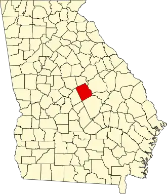
| Staat | Georgia | ||
| Coördinaten | 32°48'0"NB, 83°10'12"WL | ||
| Algemeen | |||
| Oppervlakte | 1.171 km² | ||
| - land | 1.157 km² | ||
| - water | 14 km² | ||
| Inwoners (2000) |
10.220 (9 inw./km²) | ||
| Overig | |||
| Zetel | Irwinton | ||
| FIPS-code | 13319 | ||
| Opgericht | 1803 | ||
| Website | www | ||
| Foto's | |||
.jpg)
| |||
 Bevolkingspiramide Wilkinson County | |||
| Statistieken volkstelling Wilkinson County | |||
| |||
Wilkinson County is een county in de Amerikaanse staat Georgia.
De county heeft een landoppervlakte van 1.157 km² en telt 10.220 inwoners (volkstelling 2000). De hoofdplaats is Irwinton.
Bevolkingsontwikkeling
| Jaar | Inwoners | % ± | |
|---|---|---|---|
| 1900 | 11.440 | — | |
| 1910 | 10.078 | −11,9% | |
| 1920 | 11.376 | 12,9% | |
| 1930 | 10.844 | −4,7% | |
| 1940 | 11.025 | 1,7% | |
| 1950 | 9.781 | −11,3% | |
| 1960 | 9.250 | −5,4% | |
| 1970 | 9.393 | 1,5% | |
| 1980 | 10.368 | 10,4% | |
| 1990 | 10.228 | −1,4% | |
| 2000 | 10.220 | −0,1% | |
| Bron: (en) Historical Decennial Census Population | |||